Rattlesnake Complex Fire, Montana
The Rattlesnake Complex Fire burned in Prairie County, Montana, about 30 miles (48 km) east of Miles City, Montana. NASA began tracking it on September 4, 2026. Its latest size is 15,582 acres (6,306 hectares, 63 km²), about the size of Manhattan, or about 11,805 American football fields. NASA stopped tracking it after September 4.
Containment and crews
According to the national interagency fire record, it is 100 percent contained, fully under control, with 60 firefighters and support staff assigned.
Its cause has not been determined yet.
Fire behavior reported: minimal.
Seen from space
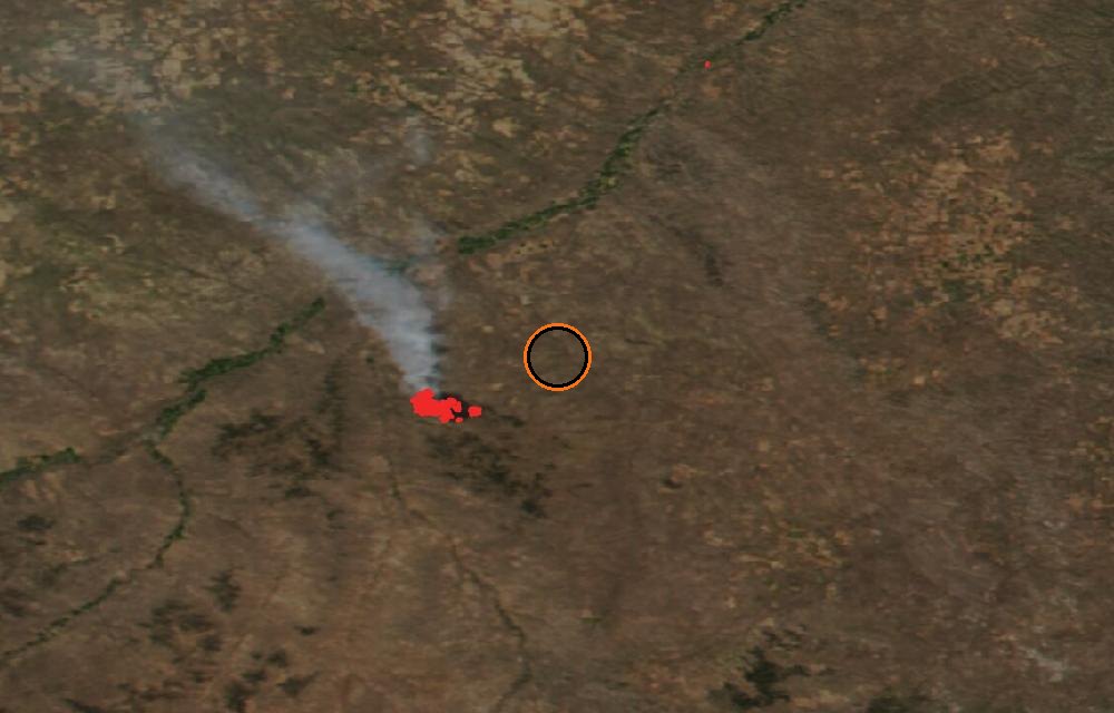
True color from the VIIRS instrument on the NOAA-20 satellite. Red dots are fires detected by their heat; smoke shows as gray-brown haze. The ring marks where the event was reported. Pictures: NASA Worldview (GIBS) from the daily satellite passes; clouds can hide the ground on some days.
Did you know?
Defensible space. Clearing dry plants and debris within about 30 feet (9 meters) of a home greatly improves its chance of surviving a wildfire.
Fire size and location from NASA EONET and the National Interagency Fire Center’s incident records (IRWIN, WFIGS). For evacuations and closures, follow local officials and InciWeb.
More: every wildfire page · all events
More from around the world
- Asteroid 2025 UK9 flies past EarthOct 31, 2026
- Falcon 9 Block 5 launch: Starlink Group 15-16Oct 24, 2026
- Long March 4B launch: Unknown PayloadOct 23, 2026
- Long March 8A launch: Unknown PayloadOct 22, 2026
- Electron launch: We're Not Hawking AroundOct 21, 2026
- Ceres-1S launch: Unknown PayloadOct 21, 2026
- Falcon 9 Block 5 launch: Starlink Group 15-15Oct 20, 2026
- H3-24 launch: Martian Moons eXplorationOct 19, 2026