U.S. weather warnings on Tuesday, October 13, 2026
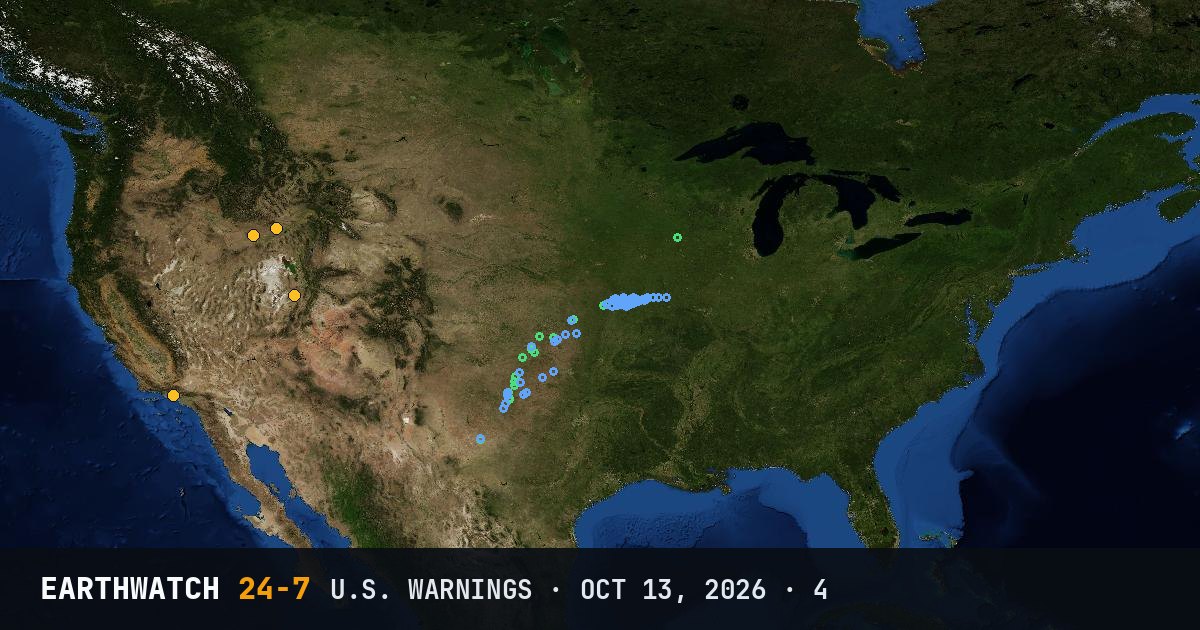
The National Weather Service issued 4 warnings across the United States on Tuesday, October 13, 2026 (UTC). The most common was the freeze warning (3). Idaho had the most (2).
By type
By state
- Idaho2
- Utah1
- California1
Storm reports
The Storm Prediction Center logged 0 tornado, 98 damaging wind and 21 large hail reports for the severe weather day from October 13 12:00 UTC to October 14 12:00 UTC. Reports are preliminary: one storm can be reported more than once. Circles on the map: tornadoes red, wind blue, hail green.
Largest hail: 2.75 inches (7.0 cm) at 22:47 UTC, 6 E Mclean, Wheeler County, Texas.
Strongest measured or estimated gust: 88 mph (142 km/h), 3 W Goodlett, Hardeman County, Texas.
Source: NOAA Storm Prediction Center storm reports.
Freeze Warning (3)
- Shoshone/Lava Beds, Arco/Mud Lake Desert, Upper Snake River Plain and 2 more areas, Idaho16:17 UTC
- Western Magic Valley, Idaho16:22 UTC
- Eastern Box Elder County, Western Millard and Juab Counties, Eastern Juab/Millard Counties and 2 more areas, Utah16:52 UTC
Red Flag Warning (1)
- Ventura County Beaches, Ventura County Inland Coast, Central Ventura County Valleys and 6 more areas, California21:38 UTC
Watch or warning?
A watch means conditions are right for a hazard to develop: be prepared. A warning means it is happening or about to happen: take action now. Advisories are for less serious hazards that still call for caution.
Land-based warnings from the National Weather Service (marine warnings and advisories are not listed). Times in UTC.