M6.7 earthquake near Carhuamayo, Peru
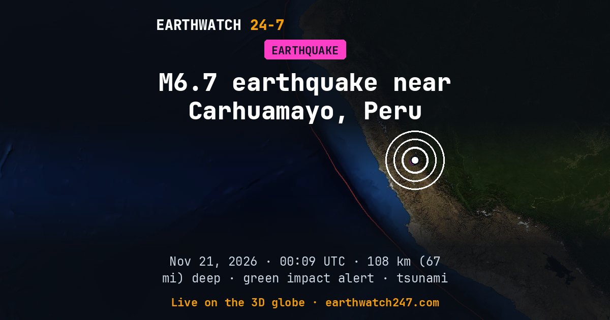
First reported as magnitude 6.9, the earthquake was revised to 6.7 by the US Geological Survey. Early estimates come within minutes from the first seismic stations; the reviewed figure takes in many more.
A magnitude 6.7 earthquake struck 9 km (6 mi) northeast of Carhuamayo, Peru on Saturday, November 21, 2026 at 00:09 UTC, at a depth of 108 km (67 mi), according to the U.S. Geological Survey. At this intermediate depth, shaking spreads out before it reaches the surface. The nearest city of a million or more people is Lima, about 177 km (110 mi) away.
USGS set its tsunami flag for this earthquake. The flag is set automatically for large earthquakes at sea and is not a warning. For official tsunami information, see tsunami.gov and your national warning center.
USGS’s PAGER impact estimate is GREEN: little or no damage expected.
Why here?
This earthquake struck 108 km (67 mi) down, about 354 km (220 mi) from the nearest plate boundary on the surface. Quakes this deep happen inside old ocean plate that has sunk far into the mantle at a subduction zone, long after it dove beneath its neighbor. Their great depth spreads the shaking over a wide area but usually keeps it gentle at the surface.
The red lines on the map are plate boundaries.
What kind of fault?
USGS’s analysis of the seismic waves shows it was a strike-slip earthquake: the two sides of the fault slid past each other sideways, like California’s San Andreas Fault.
Shaking and impact
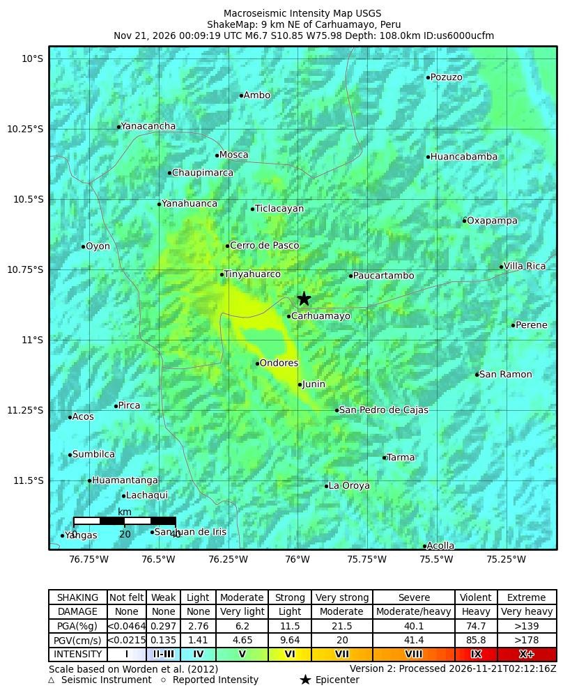
The strongest shaking USGS estimates was intensity 6 on the Modified Mercalli scale: strong. About 371,504 people were exposed to moderate shaking or stronger (intensity 5 and up). USGS’s PAGER system estimates it most likely caused no deaths (90 percent probability). Early estimates are revised as reports come in.
Shaking map
How strongly the ground shook, as USGS estimates it from the earthquake and the seismic stations that recorded it: the colors are intensities on the Modified Mercalli scale, explained under the map.
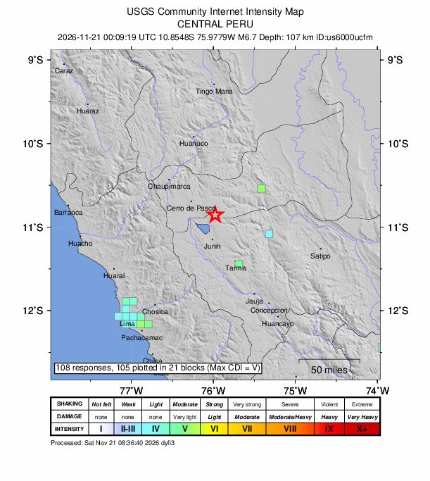
Did you feel it?
108 people told USGS’s “Did You Feel It?” survey they felt this earthquake; the strongest shaking reported was intensity 5, moderate.
How strong was it?
Magnitude is logarithmic: each whole step releases about 32 times more energy. This magnitude 6.7 released roughly the energy of 169 kilotons of TNT, about 11 times the Hiroshima atomic bomb. That is about 11,000 times the energy of a magnitude 4.0, a quake people nearby feel but that rarely causes damage. The strongest earthquake ever recorded, magnitude 9.5 in Chile in 1960, released about 16,000 times more than this one.
Aftershocks
In the first 16 hours after it, USGS recorded 1 smaller earthquake of magnitude 2.5 or more within 100 km (62 mi). It was a magnitude 5.0 on November 21 at 05:12 UTC.
- M5.0 · 0 km (0 mi) NE of Carhuamayo, PeruNov 21 05:12 UTC
Outside the United States, USGS mainly lists quakes of about magnitude 4 and up, so smaller aftershocks there are undercounted.
Earthquake history here
Before this earthquake, USGS had recorded 35 earthquakes of magnitude 6 or larger within 300 km (186 mi) since 1900. The strongest:
- M8.2 · 21 km (13 mi) SE of Huacho, PeruMay 24, 1940
- M8.1 · 67 km (42 mi) W of Paramonga, PeruOctober 17, 1966
- M8.0 · 41 km (25 mi) SW of San Vicente de Cañete, PeruAugust 15, 2007
Official details and updates: USGS event page. The shaking map, felt reports and aftershock forecast are USGS’s (public domain).
See every earthquake on November 21, 2026 or earthquakes by day.
More from around the world
- M4.8 earthquake near Salvaleón de Higüey, Dominican RepublicNov 21, 2026
- M3.3 earthquake near San Pedro, CANov 21, 2026
- M5.9 earthquake near Yanglong, ChinaNov 21, 2026
- M5.2 earthquake near Tateyama, JapanNov 21, 2026
- M6.8 earthquake near Lospalos, Timor LesteNov 21, 2026
- Cyclone XavierNov 21, 2026
- Falcon 9 Block 5 launched USSF-317Nov 21, 2026
- Falcon 9 Block 5 launch: NROL-136Nov 22, 2026