FIRE HOTSPOTS · DAILY
Fire hotspots on Friday, November 6, 2026
Satellite data to 2026-11-06 2341 UTC
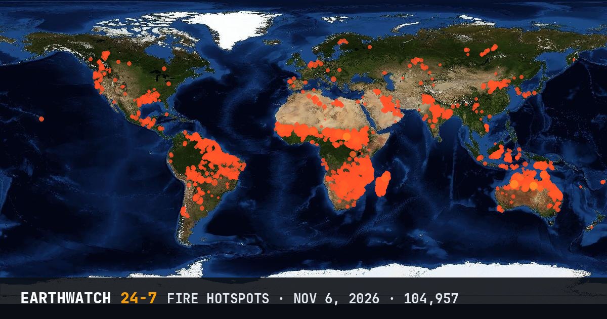
NASA’s VIIRS satellite instrument detected 104,957 active fire hotspots around the world in the 24 hours to 2026-11-06 23:41 UTC. Australia had the most (14,453, 14 percent of the world’s).
Countries with the most hotspots
What a hotspot is
Each detection is a spot about 375 meters across where the satellite saw the heat of burning: a wildfire, a farm or land-clearing fire, or sometimes a gas flare or volcano. One large fire can show up as hundreds of hotspots. Most of the world’s fires are set on purpose to clear land or burn crop waste, especially in the tropics.
Data: NASA FIRMS, VIIRS on NOAA-20. See also wildfire pages.