U.S. weather warnings on Saturday, November 14, 2026
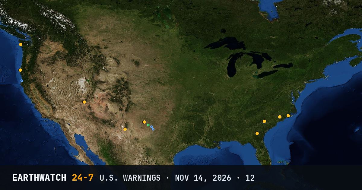
The National Weather Service issued 12 warnings across the United States on Saturday, November 14, 2026 (UTC). The most common was the freeze warning (7). NC had the most (2).
By type
By state
- NC2
- SC2
- FL2
- NM1
- OR1
- UT1
- WA1
- TX1
Storm reports
The Storm Prediction Center logged 0 tornado, 3 damaging wind and 1 large hail report for the severe weather day from November 14 12:00 UTC to November 15 12:00 UTC. Reports are preliminary: one storm can be reported more than once. Circles on the map: tornadoes red, wind blue, hail green.
Largest hail: 1.25 inches (3.2 cm) at 00:15 UTC, Tahoka, Lynn County, TX.
Strongest measured or estimated gust: 67 mph (108 km/h), 5 NW Colorado City, Mitchell County, TX.
Source: NOAA Storm Prediction Center storm reports.
Freeze Warning (7)
- Bladen, NC05:06 UTC
- Washington, Beaufort, Jones and 5 more areas, NC05:13 UTC
- Lincoln, McDuffie, Columbia and 23 more areas, SC05:23 UTC
- Jenkins, Screven, Candler and 10 more areas, SC06:07 UTC
- Coffee, Dale, Henry and 6 more areas, FL06:29 UTC
- Coffee, Jeff Davis, Bacon and Appling, FL15:36 UTC
- Gates, Bertie and Suffolk, VA23:37 UTC
Severe Thunderstorm Warning (2)
- Otero, NM, NM05:02 UTC
- Hockley, TX and Lamb, TX, TX22:42 UTC
High Wind Warning (1)
- South Central Oregon Coast and Curry County Coast, OR09:15 UTC
Flood Warning (1)
- Kane, UT and Washington, UT, UT13:40 UTC
High Surf Warning (1)
- Northern Washington Coast and Grays Harbor County Coast, WA19:40 UTC
Watch or warning?
A watch means conditions are right for a hazard to develop: be prepared. A warning means it is happening or about to happen: take action now. Advisories are for less serious hazards that still call for caution.
Land-based warnings from the National Weather Service (marine warnings and advisories are not listed). Times in UTC.