M6.1 earthquake in the Fiji region
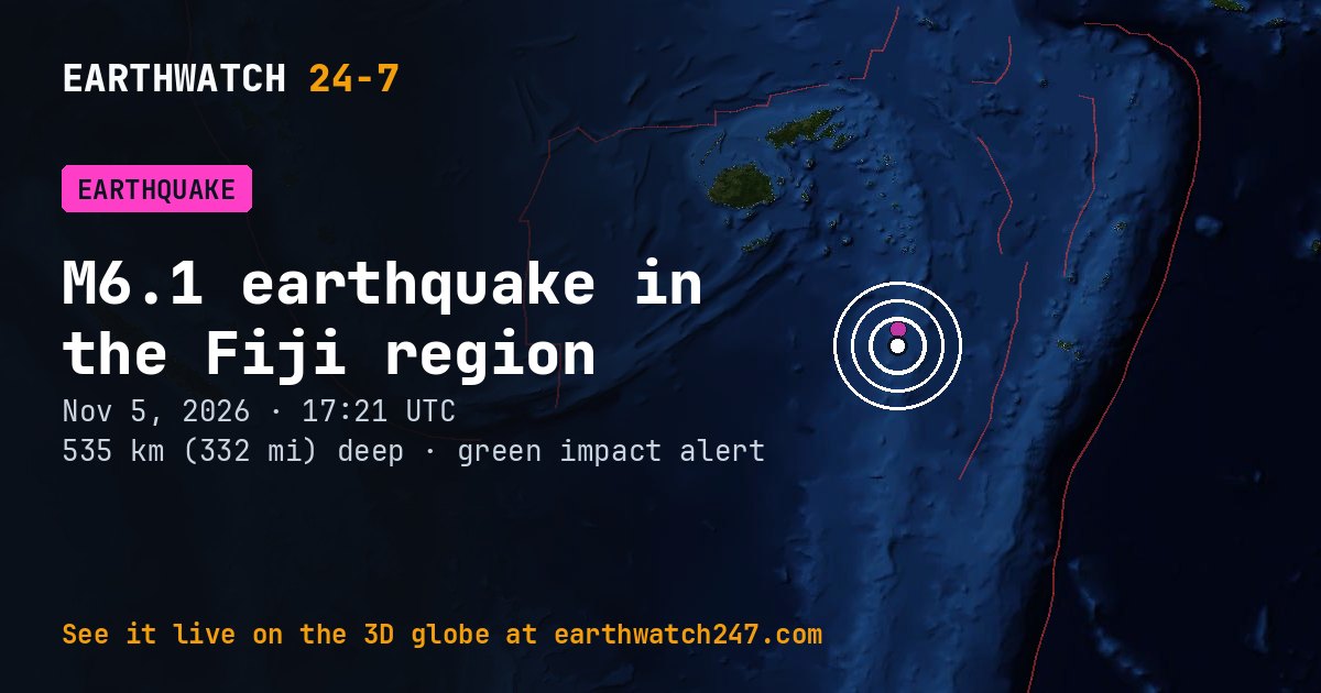
A magnitude 6.1 earthquake struck in the Fiji region on Thursday, November 5, 2026 at 17:21 UTC, at a depth of 535 km (332 mi), according to the U.S. Geological Survey. Quakes this deep are usually felt widely but rarely cause damage. The epicenter was about 362 km (225 mi) west of Nukualofa.
USGS’s PAGER impact estimate is GREEN: little or no damage expected.
Why here?
This earthquake struck about 236 km (147 mi) from the boundary between the Australian and Tonga plates. Most earthquakes happen along plate boundaries like this one, where the pieces of Earth’s outer shell collide, pull apart or grind past each other. Stress builds up over years until the rock suddenly slips. At 535 km down, it most likely broke inside a plate that is sinking into the mantle beneath its neighbor, in what geologists call a subduction zone.
The red lines on the map are plate boundaries.
What kind of fault?
USGS’s analysis of the seismic waves shows it was a normal-fault earthquake: the crust was being stretched, and one block dropped down relative to the other.
Shaking and impact
USGS’s PAGER system estimates it most likely caused no deaths (90 percent probability). Early estimates are revised as reports come in.
How strong was it?
Magnitude is logarithmic: each whole step releases about 32 times more energy. This magnitude 6.1 released roughly the energy of 21 kilotons of TNT, about as much as the Hiroshima atomic bomb. That is about 1,400 times the energy of a magnitude 4.0, a quake people nearby feel but that rarely causes damage. The strongest earthquake ever recorded, magnitude 9.5 in Chile in 1960, released about 130,000 times more than this one.
Aftershocks
In the first 2 days after it, USGS recorded 1 smaller earthquake of magnitude 2.5 or more within 100 km (62 mi). It was a magnitude 4.5 on November 7 at 15:05 UTC.
- M4.5 · Fiji regionNov 7 15:05 UTC
Outside the United States, USGS mainly lists quakes of about magnitude 4 and up, so smaller aftershocks there are undercounted.
Earthquake history here
Before this earthquake, USGS had recorded 161 earthquakes of magnitude 6 or larger within 300 km (186 mi) since 1900. The strongest:
- M7.8 · Fiji regionJanuary 1, 1919
- M7.8 · 192 km WSW of Haveluloto, TongaOctober 14, 1997
- M7.7 · Fiji regionAugust 19, 2002
Official details, updates and the shaking map: USGS event page.
See every earthquake on November 5, 2026 or earthquakes by day.
More from around the world
- M5.1 earthquake near Hihifo, TongaNov 7, 2026
- M4.9 earthquake near Gadung, PhilippinesNov 7, 2026
- M4.5 earthquake near La Gomera, GuatemalaNov 7, 2026
- M5.9 earthquake in the central Mid-Atlantic RidgeNov 7, 2026
- M4.7 earthquake near Ambon, IndonesiaNov 7, 2026
- Great Sitkin volcanoNov 7, 2026
- Kilauea volcanoNov 7, 2026
- Long March 12 launch: SatNet LEO GroupNov 8, 2026