M4.3 earthquake near Joseph, Oregon
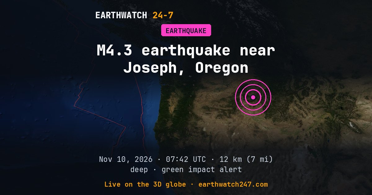
First reported as magnitude 4.6, the earthquake was revised to 4.3 by the US Geological Survey. Early estimates come within minutes from the first seismic stations; the reviewed figure takes in many more.
A magnitude 4.3 earthquake struck 18 km (11 mi) southeast of Joseph, Oregon on Tuesday, November 10, 2026 at 07:42 UTC, at a depth of 12 km (7 mi), according to the U.S. Geological Survey. Shallow quakes like this one shake the surface hardest. The nearest city of a million or more people is Portland, Oregon, about 442 km (274 mi) away.
USGS’s PAGER impact estimate is GREEN: little or no damage expected.
Why here?
This earthquake struck about 656 km (408 mi) from the nearest major plate boundary, which makes it an intraplate earthquake. These happen on old faults inside a plate, where stress from the plate’s slow movement is released. They are less common, but can surprise areas that rarely feel quakes.
The red lines on the map are plate boundaries.
Shaking and impact
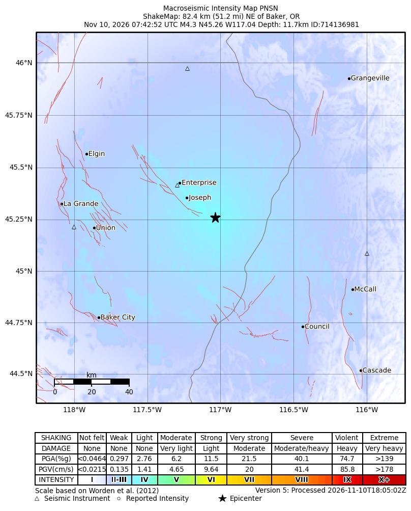
The strongest shaking USGS estimates was intensity 4 on the Modified Mercalli scale: light. USGS’s PAGER system estimates it most likely caused no deaths (95 percent probability). Early estimates are revised as reports come in.
Shaking map
How strongly the ground shook, as USGS estimates it from the earthquake and the seismic stations that recorded it: the colors are intensities on the Modified Mercalli scale, explained under the map.
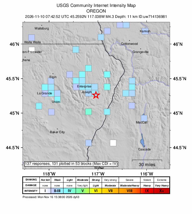
Did you feel it?
137 people told USGS’s “Did You Feel It?” survey they felt this earthquake; the strongest shaking reported was intensity 4, light.
How strong was it?
Magnitude is logarithmic: each whole step releases about 32 times more energy. This magnitude 4.3 released roughly the energy of 43 tons of TNT. That is about 2.8 times the energy of a magnitude 4.0, a quake people nearby feel but that rarely causes damage. The strongest earthquake ever recorded, magnitude 9.5 in Chile in 1960, released about 63,000,000 times more than this one.
Aftershocks
In the first 7 days after it, USGS recorded no smaller earthquakes of magnitude 2.5 or more within 100 km (62 mi).
Outside the United States, USGS mainly lists quakes of about magnitude 4 and up, so smaller aftershocks there are undercounted.
The aftershock forecast
USGS’s forecast, issued : the chance of at least one aftershock of each size, counted from when it was issued. The chances fall as time passes without one.
| Size | Next day | Next week | Next month |
|---|---|---|---|
| M3+ | 3% | 12% | 25% |
| M5+ | <1% | <1% | <1% |
| M6+ | <1% | <1% | <1% |
The most likely number of magnitude 3 or larger aftershocks over the week: 0 to 1.
From USGS’s aftershock forecast. USGS issues one for magnitude 4 and up in the United States and for many magnitude 5 and up elsewhere, and updates it as the sequence develops.
Earthquake history here
Before this earthquake, USGS had recorded 4 earthquakes of magnitude 6 or larger within 300 km (186 mi) since 1900. The strongest:
- M6.9 · The 1983 Borah Peak Earthquake, IdahoOctober 28, 1983
- M6.5 · Stanley, IdahoMarch 31, 2020
- M6.1 · 37 km (23 mi) N of Stanley, IdahoJuly 12, 1944
Official details and updates: USGS event page. The shaking map, felt reports and aftershock forecast are USGS’s (public domain).
See every earthquake on November 10, 2026 or earthquakes by day.
More from around the world
- M6.7 earthquake near Carhuamayo, PeruNov 21, 2026
- M4.9 earthquake near Pangai, TongaNov 20, 2026
- M5.1 earthquake near Port-Olry, VanuatuNov 20, 2026
- Tornado Warning: San Benito, CANov 20, 2026
- Tornado Warning: Merced, CANov 20, 2026
- Great Sitkin volcanoNov 20, 2026
- Kilauea volcanoNov 20, 2026
- Long March 6C launch: undisclosed payloadNov 21, 2026